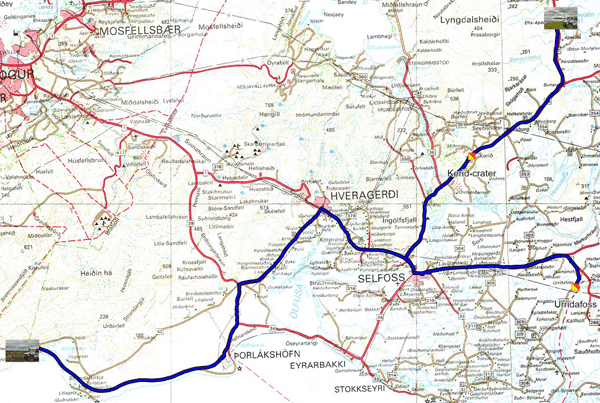
The GPS road tacklog,
Clic on the pic for opening it
from Bildsfell to xx
from 2021/08/02 to 2021/08/02
Herdisarvik
Monday August 2nd I was heading to the south coast of Iceland to
visit some nearby sites. The first two, Reykjadalur Valley and
Raufarholshellir Lava Tubes did not catch my attention. However, the
crossing of Hveragerdi was the occasion to see horticultural
greenhouses heated by electricity. As a reminder from Wikipedia "In
2018, electricity production reached 19,830GWhs, of which 13,814, or
69.7% by hydroelectric power stations and 6010GWhs, or 30.3% by
geothermal power stations; wind power produced 4GWhs.
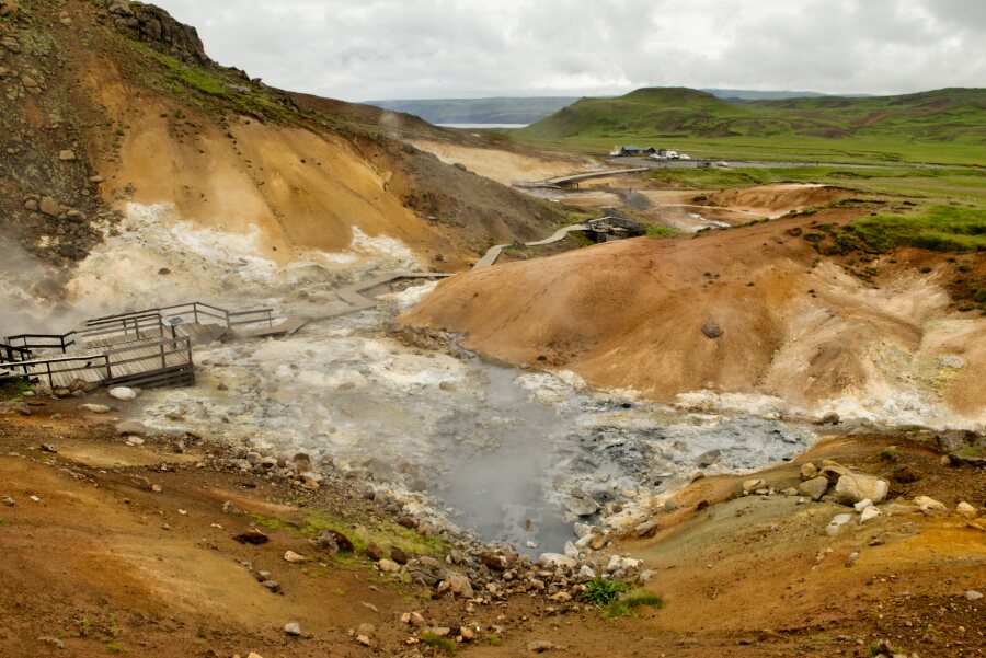
Seltún-Krýsuvík Geothermal Hot Springs was a wonder of sulphide
colors and smells. Alas, the trail to Pinir, Hot Spring, is very
steep and slippery, although equipped with walking stick I gave up
this challenge. Grænavatn crater comes from the collapse of the
ejection cone and the water is of underground origin I found a
bivouac in Herdisarvik.
click on the pic for opening the gallery
|
| Seltún-Krýsuvík |
The GPS road tacklog,
Clic on the pic for opening it
from Herdisarvik to Apavatn
from 2021/08/03 to 2021/08/03
Apavatn
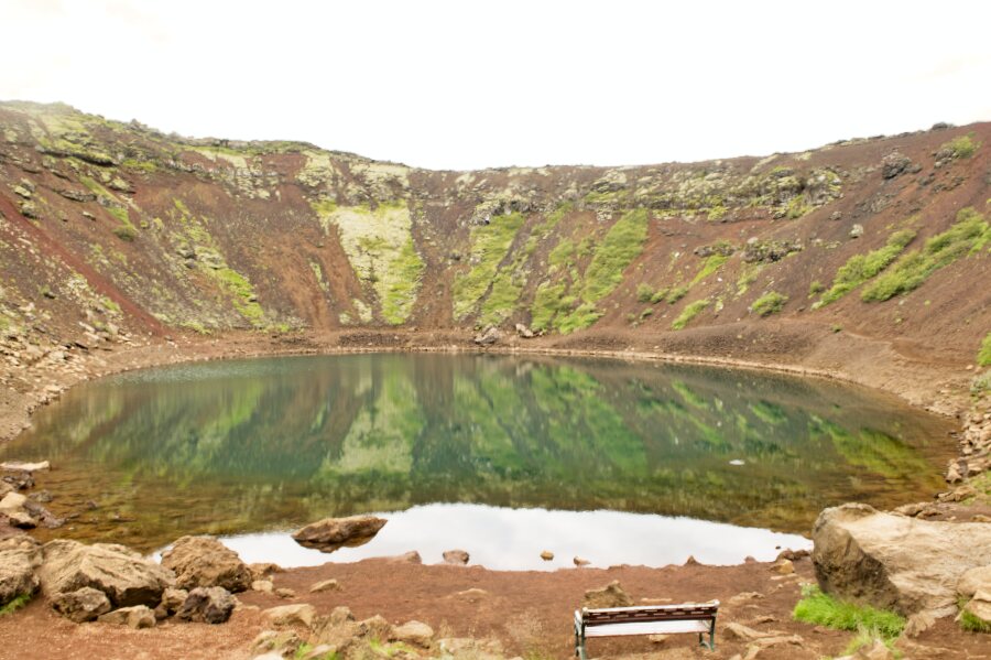
Tuesday August 3 before the rain fell at the beginning of the
afternoon I first visited Kerid crater a geological exception since
recently the geologists have definitively solved the enigma of this
volcano which is the consequence of the collapse of the cone after
an eruption about 6,500 years ago. The water in the lake comes from
the aquifer. Then I went to see the Urridafoss waterfall whose
specificity is to have the largest flow in Iceland, 360 m3 per
second. Anglers with an ad hoc permit can attempt to catch salmon
and trout. I bivouacked in the direction of Laugarvatn.
click on the pic for opening the gallery
|
| Kerid-crater |
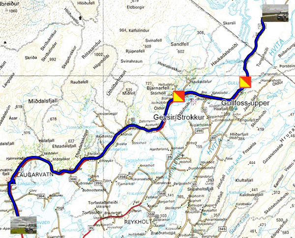
The GPS road tacklog,
Clic on the pic for opening it
from Apavatn to Sanda-river
from 2021/08/04 to 2021/08/04
Sanda-river
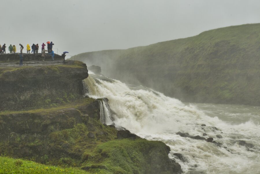
Wednesday August 4 the rain was there all morning. The first visit
concerned the geysers, Geysir which does not appear since the year
2000 following an earthquake, only Strokkur sends a jet every 10
minutes at 15 or 30 meters in height. Of course there were crowds
waiting for the event. 10 km further on, the magnificent Gullfoss
waterfall, a sign gives the photo of a rainbow in good weather! I
continued on route 35 to find a bivouac on the edge of the Sanda-river.
The sky cleared up around 5:00 pm, a few rays of sunlight warming
the atmosphere.
click on the pic for opening the gallery
|
| Gullfoss |
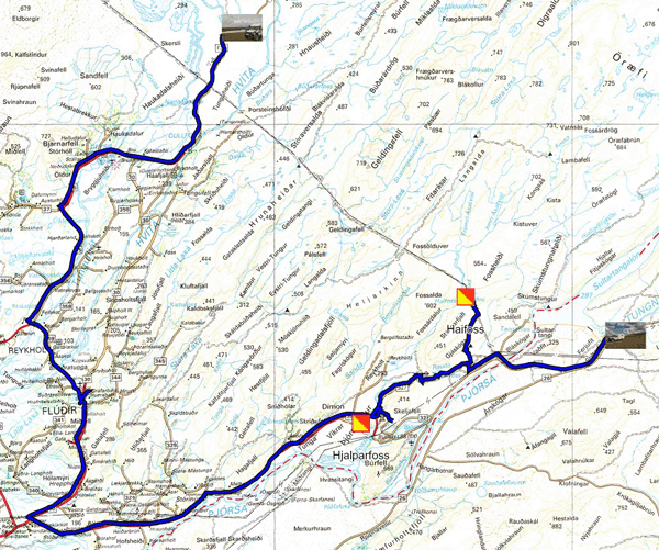
The GPS road tacklog,
Clic on the pic for opening it
from Sanda-river to route 26
from 2021/08/05 to 2021/08/05
Route 26
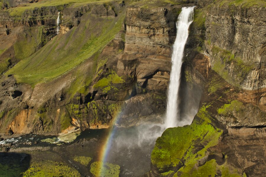
Thursday August 5 was a mixed day, sunny morning and afternoon light
rain. I had planned a hot bath in Fludir's Hot-pots, Secret-lagoon,
oddly it doesn't open only at … 8:00 pm; I went my way. Then I
visited two waterfalls, the first Fjalparfoss, which is a double
side-coast waterfall; then the second Haifoss also a double waterfall
but separate and, of great height. Bingo I was lucky enough to see a
rainbow. At the start of the afternoon I found a bivouac of some
sort, but with a little flower, reminding me of a Sydney Bechet hit.
click on the pic for opening the gallery
|
| Haifoss |
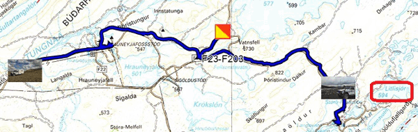
The GPS road tacklog,
Clic on the pic for opening it
from route 26 to Stora-river
from 2021/08/06 to 2021/08/06
Stora-river
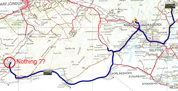
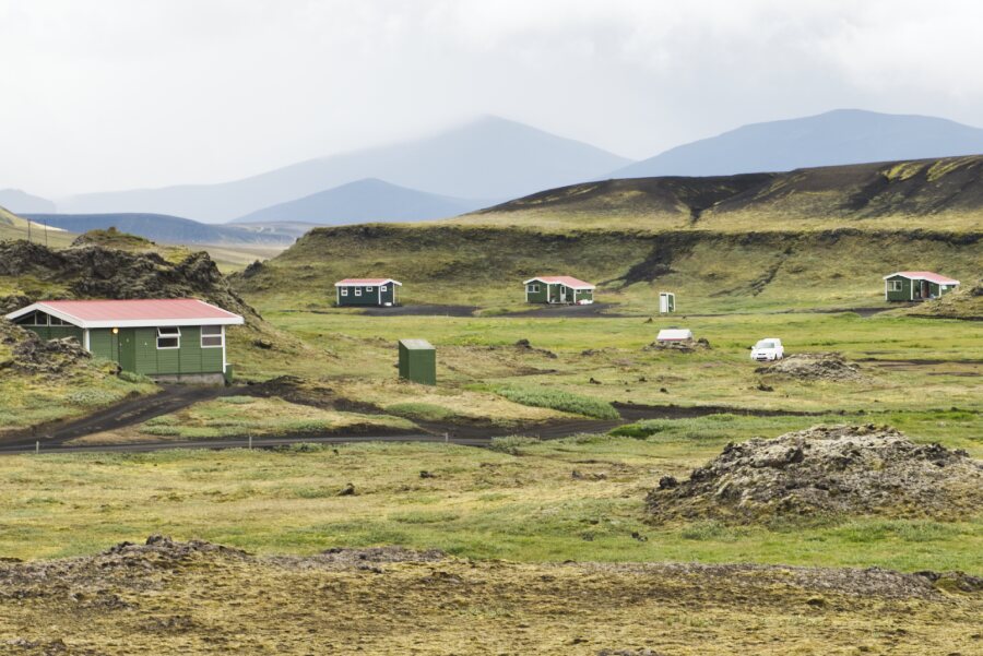
Friday August 6 was a trip in the highlands of Iceland, around +550
meters altitude, alas it was a gloomy weather with of course rain.
By a gravel road I came to an angling village in the Litlisjor lake
region. After crossing two fjords, one of which was signposted,
I retraced my steps to bivouac at the water's edge.
click on the pic for opening the gallery
|
| Anglers' village |
The GPS road tacklog,
Clic on the pic for opening it
from route 26 to Stora-river à Jökuldalakvisl
dfrom 2021/08/07 to 2021/08/07
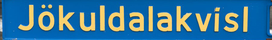
Jökuldalakvisl
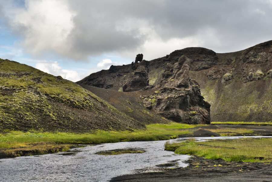
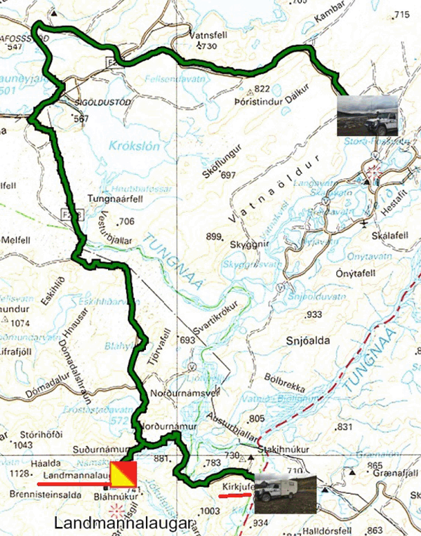
Saturday July 7 again a gloomy day, leaden sky without rain. A trip
in the Fjallabak National Park with a stop at Landmannalaugar then a
passage at Kirkjufell to leave the park in order to find a bivouac.
The landscapes are austere but grandiose by the black color of the
excreta from volcanoes for millions of years. Numerous rivers of
glacial origin crisscross the region with fords to be crossed
feeding artificial lakes for power stations attested by gigantic
pylons carrying electric cables.
click on the pic for opening the gallery
The GPS road tacklog,
Clic on the pic for opening it
from Jökuldalakvisl à Hvolsvöllur
from 2021/08/078 au 2021/08/08
Hvolsvöllur
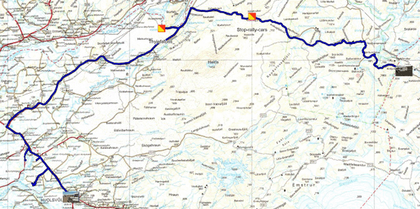
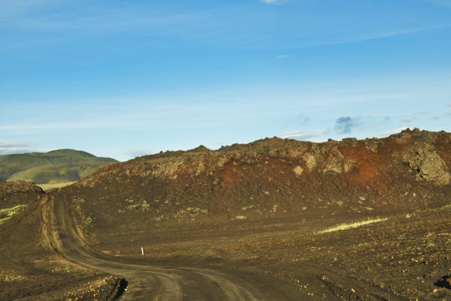
Sunday August 8 I left the bivouac of Jökuldalakvisl to stroll along
the gravel road F225 in sublime landscapes with a low angle light of
the rising sun between 6 and 8 o'clock in the morning. Shortly
before the junction with the F26 I was stopped by two marshals of a
rally of six 4x4, Icelandic gauge. I got to know the organizer of
this rally. Two German bikers were also stopped. Then I visited the
waterfall, Thyjofafoss, having the visit of a troop of riders
accompanying horses. I traveled route 26 to Hella then the R1 to
Hvolsvöllu without finding a bivouac; I had to be happy with the
parking lot of the Lava Center.
click la photo pour ouvrir la galerie
|
| F225 gravel road |