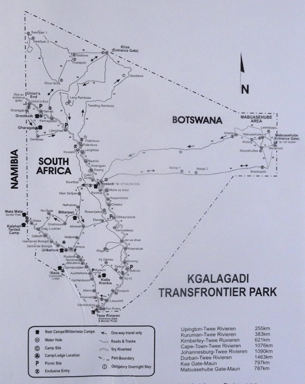
Kgalagadi
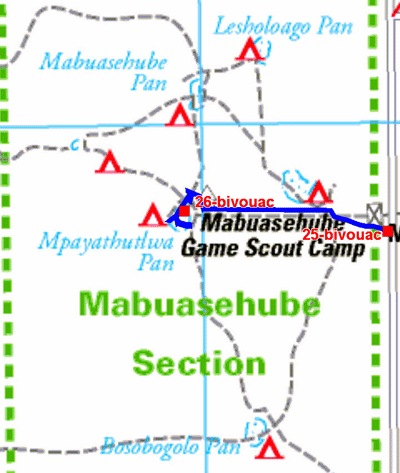
Mabuasehube Pan
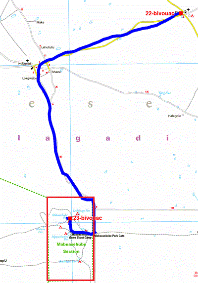
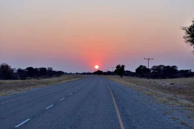
Due to the distance to reach Mabuasehube with a sandy track, I left
Kang around 6:00 a.m. I stopped in Hukuntsi having seen a pylon of
telecommunications hoping for a WiFi connection to publish the last
page of my site, bingo, good connection. I continued my way to
arrive at Transfrontier Kgalagadi Park; then after the formalities
entered to find Mabuasehube campsite inside the park. It was 15:30
without having a lunch pause.
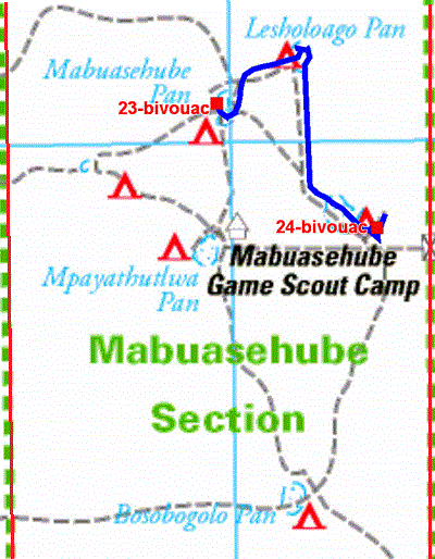
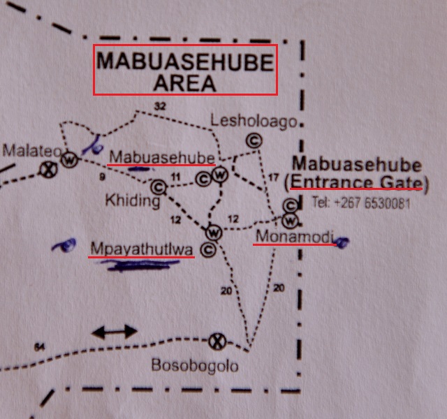
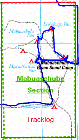
The GPS road tracklog
from Mabuasehube Pan to Monamodi Pan
from 2018/08/21 to 2018/08/21
Monamodi Pan
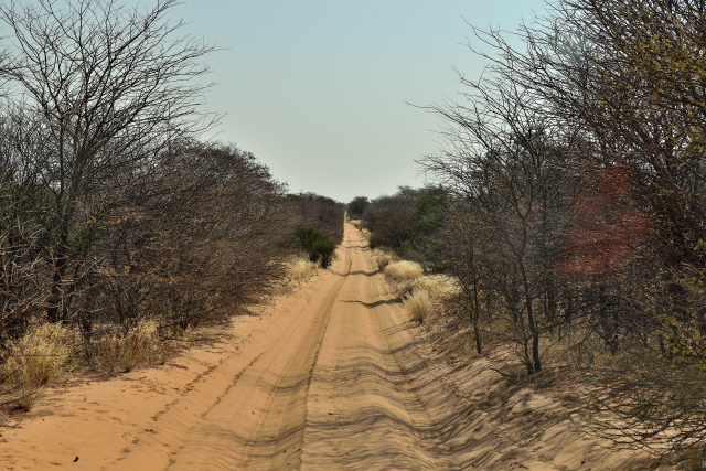
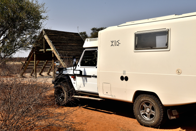
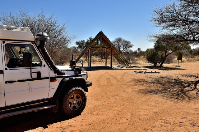
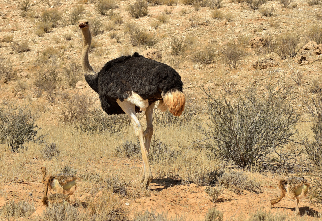
Tuesday, August 21 I visited at low speed three ponds, Mabuasehube,
Lesholoago then Monamodi. They were without water, dry. There were
no animals except a race of buffaloes on Lesholoago Pan!
Consequently, I was interested with birds and small animals of the
desert. I bivouacked at the Monamodi campsite #1.
click on the pic for opening the gallery
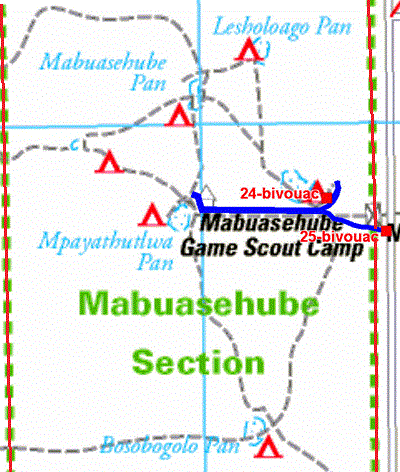
The GPS road tracklog
from Monamodi Pan to Entrance Gate
from 2018/08/22 to 2018/08/22
Entrance Gate
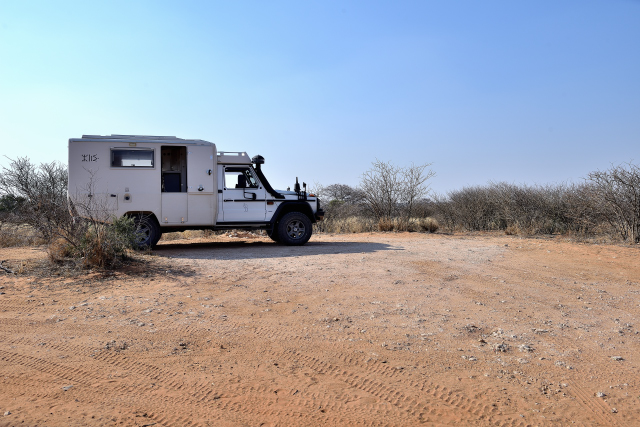
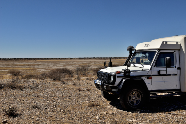
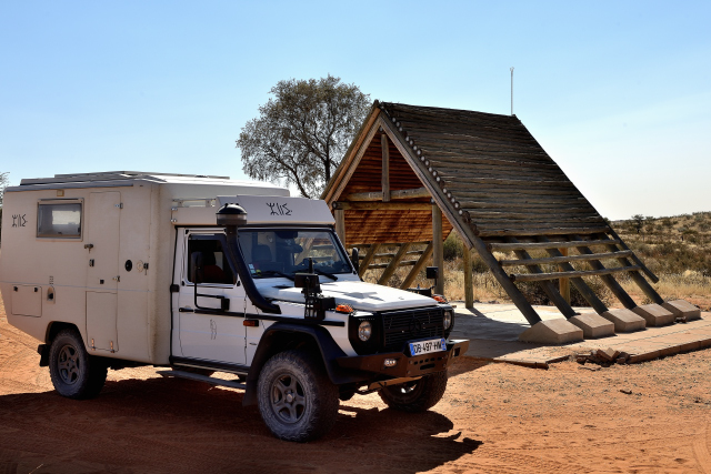
In spite of a morning departure on Wednesday, August 22 I observed
only very few wild animals. All the ponds are dry. Moreover there is
no artificial water supply point, as in Kalahari. I bivouacked with
the campsite #1 of the Entrance Gate, not liking!
click on the pic for opening the gallery
the GPS de la route
from Entrance Gate to Mpayathutlwa
from 2018/08/23 to 2018/08/23
Mpayathutlwa
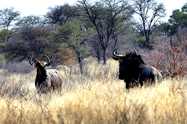
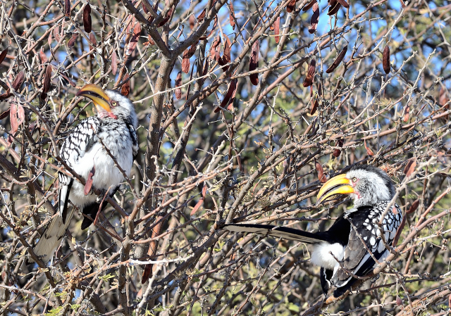
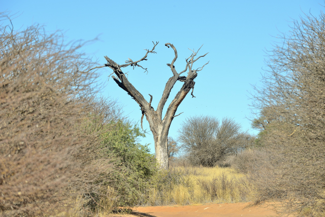
Thursday, August 23 I left the bivouac to be at sunrise at
Mpayathutlwa Pan only artificial water hole artificial in function.
Where the staff of the park had mentioned me the presence of lions,
que nenni! The first newcomers were the springboks always very
apprehensive, fussy neighborhood before sitting at table of the
water hole raising the head with least rustles suspect. Then it was
a fox, trots-finely, also looking at furtively before approaching
the basin. A lot of birds fell down on the water hole driving out
the other drinkers. Finally the cohabitation is established
liking-with-liking. I vainly sought the campsite #1 of war-mow I
bivouacked on a flat space in overhang of the pond.
click on the pic for opening the gallery
|
| Coudoiement au point d'eau au lever du soleil, Contact at the water hole at sunrise |
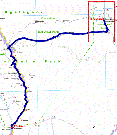
The GPS road traklog
from Mpayathutlwa to Two Rivers
from 2018/08/24 to 2018/08/24
Two Rivers
In the night of Thursday August 24th I left to carry out the 340 km
of corrugated track from Mpayathutlwa Pan to Nossob then to Two
Rivers. The part up to Nossob is called Wilderness Trail where
little before Nossob I was lucky to see two cheetahs walking. I
succeed in taking some pictures of this unforeseeable occurrence as
much as unhoped-for. Admittedly the pictures are unspecified, but
finally. I discovered that Nossob is in South Africa and that the
track of good quality to the border is also in South Africa whereas
Two Rivers, spot of my bivouac, is at a few meters in Botswana
almost opposite Twee Rivieren. I put 11 hours to make the way! I
remained until August 30th in the basic Two Rivers Campsite to have
the visa of only seven days allowing me to make the return ticket to
France to obtain on my return in South Africa a 90 days hoped visa.
click la photo pour ouvrir la galerie
Gemsbok/Bokspits, frontière Botswana/Sud Afrique
Exit Botswana, BW
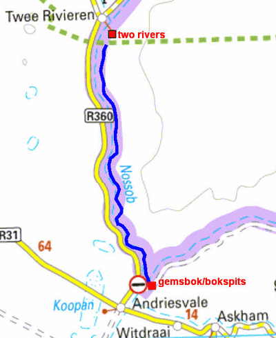
The GPS road tracklog
from Two Rivers to Gemsbok/Bospits
from 2018/08/30 to 2018/08/30
On Thursday, August 30 I definitively left Botswana after a
beautiful crop of memories and pictures of wild animals at the
border post of Gemsbok, Botswana, then of Bokspits, South Africa;
the office immigration is in a building common to both countries at
Twee Rivieren! The overview of the track carried out opposed to the expected
track is
here.