-- From Darwin to Pine Creek
The road tracklog
from Darwin to Pine Creek
from 13 to 18/10/2009
The 14/10 finally I left Darwin to head to Berrimah to pay the Sitebark bill at 08:30am. I obtained a thin discount by rounding at A$2000. I filled the tank with water, good idea. Then I headed to the representative of MAN in Pineland to take filters which I had ordered, air filter and aircon filter. Finally I rolled towards Litchfield Park with a first stop in Batchelor, small village with a supermarket and a Information kiosk. I became acquainted with a couple of Australian.
Litchfield National Park
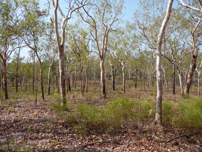
The park, next to Darwin, is a sandstone plateau very popular with its rainforest, its waterfalls where it is possible to swim.
By heading to Wangi Falls Campground I visited the magnetic termite mounds. They are true cathedrals directed towards the north making it possible insects to migrate according to the orientation of the sun.
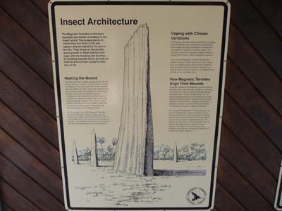
Magnetic termite mounds
Litchfield Park
14/10/2009
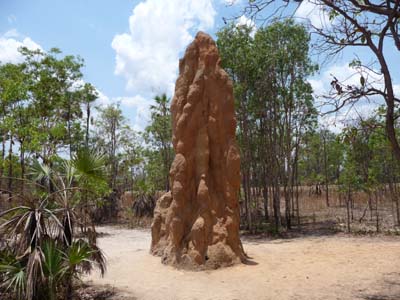
Magnetic termite mounds
Litchfield Park
14/10/2009
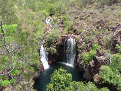
Then I stopped at some water falls which were in this dry season meagrely, Florence Falls, Tolmer Falls, and Wangi Falls.
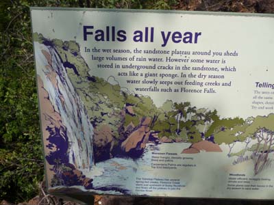
Falls
Litchfield Park
14/10/2009
Florence Falls
Litchfield Park
14/10/2009
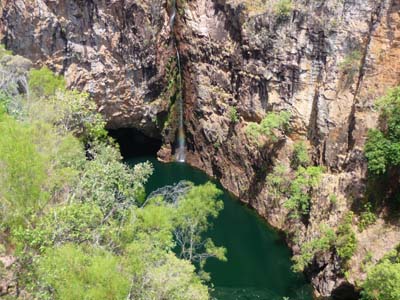
Tolmer Falls
Litchfield Park
14/10/2009
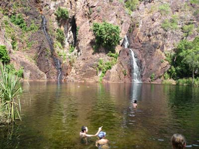
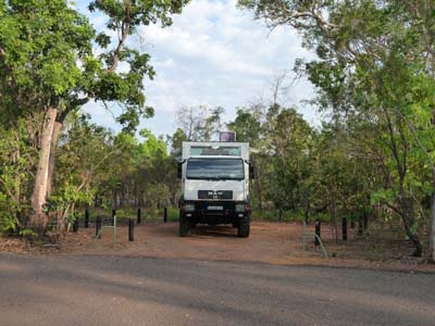
At the campground of the latter I choose a bay then I were going to take a bath in the plunge waterfall. It was resting after a road under a heat of approximately 36°C. Then I continued the start-up of my truck by installing the bought filters and a water filter. These filters had been thrown before AQIS inspection. Park Managed Campgrounds, are paying between A$6,6 and A$10 per person collected in an envelope on which one registers his name and his vehicle registration number. A detachable voucher is put on dashboard. They are equipped with sanitary blocks of an impeccable cleanliness.
Wangi Falls
Litchfield Park
14/10/2009
Wangi Falls Camp
Litchfield Park
14/10/2009
The 15/10 I moved towards Ubirr while passing by Beryy Springs what implied 45 kilometres of Gravel Road of which a part was under work.
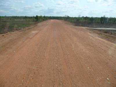
Gravel Road
en route
15/10/2009
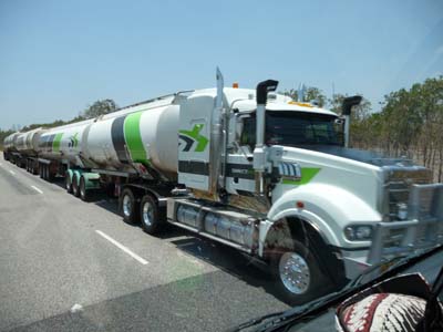
Road train
en route
15/10/2009
Kakadu National Park
The park, registered at the World Inheritance of Humanity, is managed jointly by the Australian park administration and traditional owners, Bininj in the north and Mungguy in the south. It covers nearly 20,000 km ² with an exceptional diversity of stony plateaus, red escarpment cliffs, waterfalls, billabonds, twisting rivers, etc...
On the way I visited Mamukala and the bird observatory which in middle of day and under approximately 37°C were not visible.
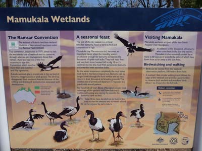
Observatoire
Mamukala
15/10/2009
The next stop was at Bowali Visitor Centre where I collected booklets and I visited very didactic Culture Centre. Finally after a last stop in Jabiru I settled at Merl Campground where I met rangers who collected fees.
Bowali Visitor Centre
14/10/2009
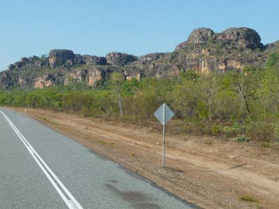
Falaise
en route
15/10/2009
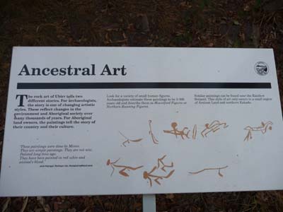
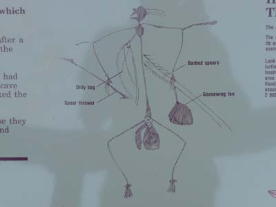
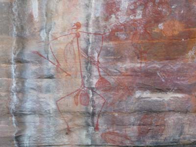
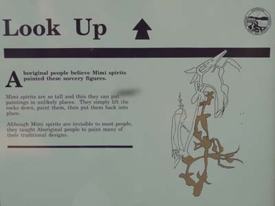
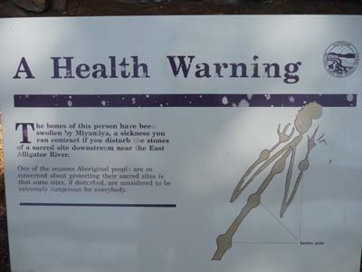
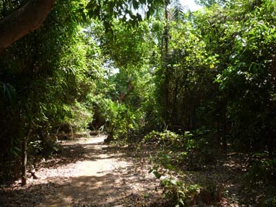
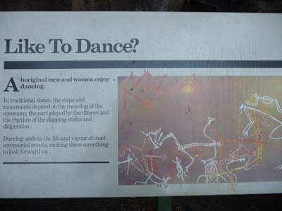
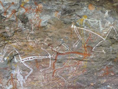
The 16/10 around 08:30am I left for Ubirr to traverse the one kilometre track to see aboriginal rock art. Trip commented with many explanatory panels, in English only. It was a enthralling and enriching visit.
Aboriginal Rock Art
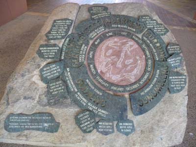
Painted Shelters, parietal art corresponds so that Australian call Aboriginal rock art. It describes the Aboriginal day life as well as their religious beliefs. X-ray art shows the internal and external anatomy alive beings. Some paintings tell stories for teaching the values of people or a clan. Kakadu NP has more than 5,000 sites of rock arts under shelters which date back from 20000 years to 10 years.
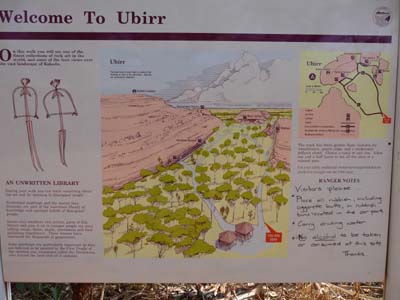
Ubirr
16/10/2009
Ubirr
16/10/2009
Ubirr
16/10/2009
Ubirr
16/10/2009
Ubirr
16/10/2009
Ubirr
16/10/2009
Ubirr
16/10/2009
Then I travelled Manngarre Rainforest Walk going along East Alligator River, stunning forest peppered this salutary walk. I headed back to Merl Campground about midday. In the afternoon I prepared the publication of my website and completed the setting in running order of my truck. The temperature in it was about 41°C.
Manngarre walk
16/10/2009
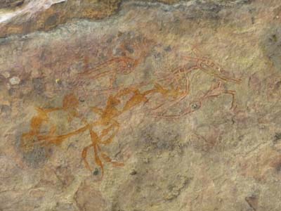
The 17/10 was still a day dedicated to approach the Aboriginal culture the visit of the sites of Nourlangie and of Nanguluwur which was completed at Yellow Water by exceptional Warradjan Aboriginal Cultural Centre. Around 02:00pm I established my bivouac at Mardugal Campground.
Nourlangie exhibit paintings of the day life.
Nourlangie
17/10/2009
Nourlangie
17/10/2009
Nourlangie
17/10/2009
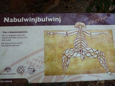
X-Ray art
Nourlangie
17/10/2009
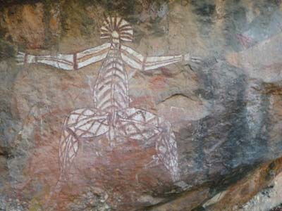
X-ray art
Nourlangie
17/10/2009
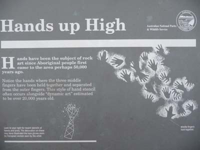
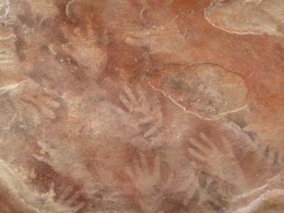
Nanguluwur gives to see paintings of negative hands such de Lumley describes them and comments on them in his book "L'homme premier" by thinking up a communications theory.
Nanguluwur
17/10/2009
Nanguluwur
16/10/2009
Warradjan Aborginal
Culuture Centre
17/10/2009
Any surrounding the bush covers the area, one meets bushmen, funny people.
Le bush
17/10/2009
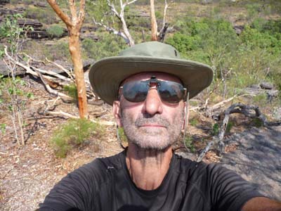
a bushman
Auto portrait
17/10/2009
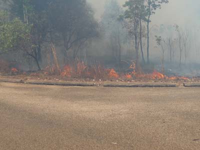
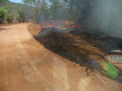
Fire at Gunlom Falls
Sunday October 18 I moved towards Gunlom Falls, there was a fire in a close small valley. Whereas I left to see the very famous waterfall, the sky was getting darkened abruptly and a strong smell of burning was spreading. I looked back and I saw a fire undergrowth to arrive at sharp pace. I turned back precipitately to my truck and I was heading to a carpark. Since my arrival in Australia it was my first bush fire, very impressive. After a few moments of observation I decided to leave towards another more welcomed bivouac. Alas I rolled up to Pine Creek.
Gunlom Falls
18/10/2009
Gunlom Falls
18/10/2009